Local Coordinates
|
1238888 |
When scanning, the position of the scanner emerges as the natural origin of the coordinate system because when recording the scan, all position specifications of the points are initially recorded in relation to the scanner. This coordinate system is therefore described as the local coordinate system.
Due to the rotation of the scanner, its natural coordinate system is the polar coordinate system, with which two angles and a distance value are used to determine the position.
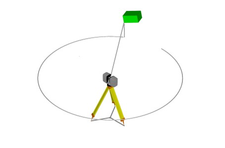
Figure 15-1 Polar coordinates
For the single scan points created by the scanner, you can find the polar coordinates in the bottom status bar:

Figure 15-2 Display the polar coordinates of a scan point
Cartesian Coordinates
In day to day use, you would generally use Cartesian coordinates, which have a direct reference to concepts such as length, width and height, rather than polar coordinates.
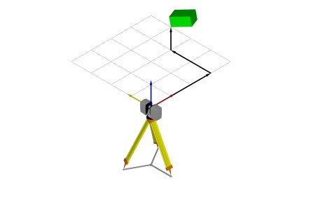
Figure 15-3 Cartesian coordinates

Figure 15-4 Display of the Cartesian coordinates of a scan point