Using the Sun Position Calculator for Google Satellite Images
Use the Sun Position Calculator to easily add the correct position of the sun for imported Google satellite images. The sun position calculator automatically extracts the latitude and longitude from the Google map image. You can also manually enter GPS data.
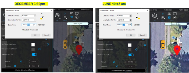
To use the sun position calculator:
1. Place a Google satellite image in the drawing.
2. From the Enviro ribbon, click  Sky.
Sky.
3. From the Sky-Environmental Lighting tool panel, click Calculate Azimuth and Elevation. The Sun Calculator dialog displays.
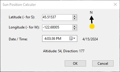
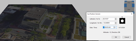
The Latitude and Longitude settings are configured in the Sun Position Calculator dialog. You can adjust them manually if you need to.
5. Set the date and time, and click Ok.
