Scan Manager and Scanner Tool Panel
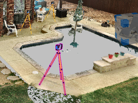
Use the Scan Manager to control scanner positions. Scanners display automatically in point clouds from Zone2go project files. Seeing the scanner locations helps you select the scan positions to save with your Zone2go project.
The Scan Manager displays the scanner models and their locations. You can open the Scan Manager from Zone2Go, or from  Cloud Tools in the Point Cloud ribbon.

Select from the following options in the Scan Manager dialog:
| Show All/Hide All | Show or hide scanner models in the project. Hide All automatically unchecks selected Export checkboxes. |
| Export All | Select all scans for export. |
| ID | The scanner ID. |
| Scan Name | The name of the scan, along with the scan number. |
| Visible | Hide the scanner models, but export their images if Export is checked. |
| Show Tripod | Show or hide the tripod. |
| Export | Include the scanner model and its images in the Zone2go project. |
| Zone 360 Pano |
Open an existing panoramic image, or generate an image at the scanner location. The pano images are exported with the Zone2go project. In the Zone2go project, you can view the pano image or the 3D View (point cloud data). Original pano images typically display in higher resolution than generated pano images. If no original pano images exist, the software creates a pano image when you select the checkbox. To save the Zone pano images as part of the delivery package for Zone2go, save the drawing as a project (fzproj). The pano images are not included in the project if you save the drawing as a .far file. |
Scanner Tool Panel
To configure options for a scanner, select the scanner and then adjust settings in the Scanner tool panel. The scanner model spins when you select it.

 Layer Manager Layer Manager
|
Display the Layer Manager to add or edit the layers. |
 Scan Manager Scan Manager
|
Open the Scan Manager.
The Scan Manager lists the scanners in the point cloud. You can display or hide the scanners by checking the selection under Visible. |
| Name | Displays the name of the selected scanner, along with the scan number. You can edit the name. |
| GPS Location | Displays the GPS location of the scanner (for scanners that capture GPS data). |
| Axes X, Y, Z | Adjust the position of the scanner along the axes. |
| Apply to All Scanners | Apply the settings for making the scanners and tripods visible in the drawing, |
| Visible | Enable or disable this option to display or hide the selected scanner in the drawing. Visible determines whether the scan data is included in a Zone2go package. If Visible is deselected, the scan data (at that position) is not exported with the Zone2go project unless you check the Export box. |
| Show Tripod |
Enable or disable this option to show or hide the tripod.
|
| Pano Manager | |
| Show Pano View | Generate a 360-degree panoramic image from the scanner location. This option is also available in the Scan Manager. After you create a pano view, disable Point Cloud Visible to clearly view the pano image. |
| Point Cloud Visible | Display or hide the point cloud. |
| Pano Virtual Depth Mode | With Pano Virtual Depth Mode enabled, the software detects the depth of the panoramic image using the hidden point cloud to obscure the scene geometry. This provides a better display. |
| Greyscale (Reflective) Pano |
Show the pano image in greyscale. In this view, you can clearly see reflections, blood spatter, etc.
|


