Import a Point Cloud into Your Project
|
1238888 |
You can import and align a point cloud into an existing project.
You can import more than one point cloud into your project and you can also mix different point cloud types and 3D models. Note however, that you can only select one point cloud or 3D model at a time, i.e. you will have to repeat the procedure described below for each point cloud or 3D model.
-
Click the Import data button in the project structure view.
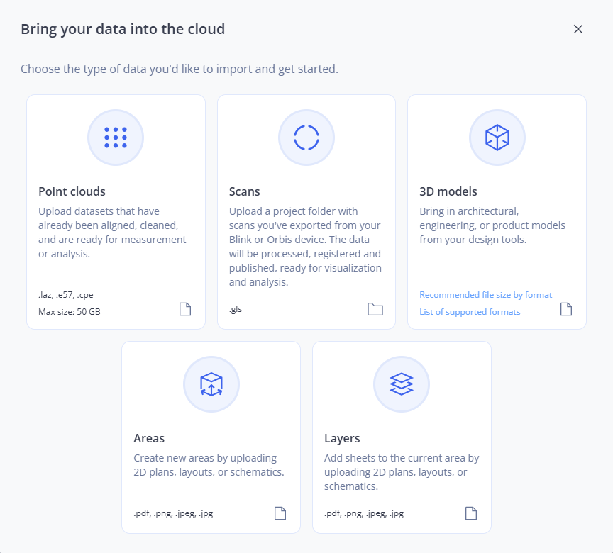
Figure 1-113 Import data form
-
Click the Point clouds tile.
The maximum file size of the point cloud is 50GB.
-
Select the point cloud you want from the file system and confirm.
For existing projects, you can also drag the file directly onto the Import form.
The following form will be displayed.
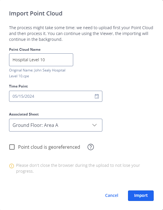
Figure 1-114 Import point cloud
-
If required, change the name of the point cloud.
-
Select a date and time in field Time Point.
You can set the date and time when the point cloud was actually captured. -
If the project contains more than one area, select the document you want in field Associated area.
-
Mark checkbox Point cloud is georeferenced if the point cloud has been previously aligned to a 3D model which you have already imported or to survey points.
-
Click the Import button to start the point cloud import.
The point cloud is being uploaded and processed. The cloud icon at the top right corner of the screen indicates the progress with a blue progress wheel, for example ![]() .
.
Clicking this icon opens a popup showing current and recent importing and exporting procedures.
Uploading and processing may take some time. You can continue to work in the Sphere XG Viewer. Leave the browser window or tab open until the import is finished. Otherwise, all progress will be lost.
When the procedure is finished, the point cloud is displayed in the project structure view on the Capture tab with an ![]() icon, indicating that the point cloud is not yet aligned.
icon, indicating that the point cloud is not yet aligned.
If you have uploaded a previously georeferenced point cloud, it is displayed in the project structure view with icon ![]() .
.
Supported File Types
You can upload the following point cloud types.
-
.laz
-
.e57
-
.cpe
