Import .geoslam Files
|
1238888 |
You can import and process raw data sets in .geoslam format captured by handheld scanners into SCENE.
You can either:
-
Drag and drop a .geoslam file onto the SCENE start page to create a new project.
-
Import a .geoslam file into an existing SCENE project.
.geoslam files can be captured by the following devices:
-
FARO Orbis Premium
-
FARO Orbis
-
ZEB Horizon (with or without camera)
-
ZEB Revo RT
In SCENE, the .geoslam file will be processed by a special SLAM processing. You can define processing settings on the Processing settings page, see Processing Settings for SLAM Scanner.
If you capture scans with the ZEB Revo, ZEB Go or ZEB1, which produce .zip files, you can import these .zip files into GeoSLAM Hub and export them into .geoslam format or use the SLAM processing in Connect to create .geoslam files.
Resulting SCENE Project
The resulting SCENE project will contain:
-
Flash scans with the associated high-resolution images
-
SLAM point cloud(s)
-
Folder with project images
-
Trajectory, i.e. the path or sequence of locations that a mobile scanner follows during data collection. Images or Flash scans are shown as dots on the trajectory.
-
Reference points if available
If you import a .geoslam file into an existing project, the output files will be available in a locked cluster.
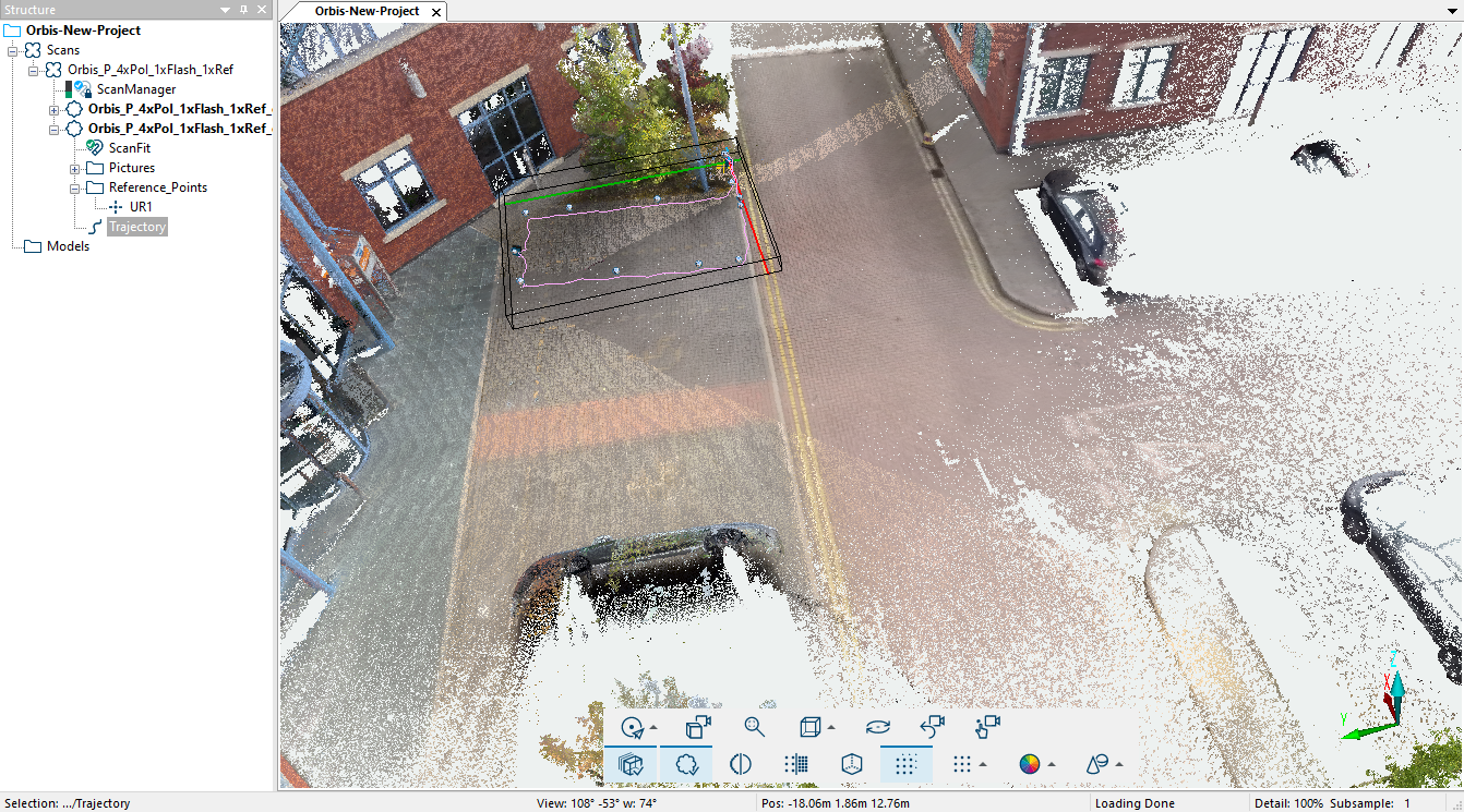
Figure 7-5 New SCENE project based on an imported .geoslam file